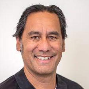
Laise Harris
" loading="lazy" decoding="async">
Senior Researcher - Land Mapping Programme Leader
Qualifications
MCI Institute
Diploma of Leadership and Management
2018
Deakin University Australia
Bachelor of Environmental Science (Honours)
2004
Deakin University Australia
BSc (Marine and Freshwater Science)
2004
Information Systems Examinations Board
Foundation Certificate in IT Service Management
2004
Rangahau · Related projects
LiDAR technology offers unprecedented access to the whenua—capturing the contours of the landscape at fine detail and revealing wāhi tapu and heritage sites often lost under forest canopies or inaccessible locations. This research explores how hapū and iwi can utilise geospatial technologies like LiDAR to identify, connect-with, and enrich the management…
View projectMā te Taiaho Matawai kia Whakahura Ngā Korero o Nehe – Laser Beam Scanning Technologies for Unlocking Landscape Narratives
LiDAR technology offers unprecedented access to the whenua—capturing the contours of the landscape at fine detail and revealing wāhi tapu and heritage sites often lost under forest canopies or inaccessible locations. This research explores how hapū and iwi can utilise geospatial technologies like LiDAR to identify, connect-with, and enrich the management of, culturally significant sites.
Kairangahau · Researchers
-
Dr. Susanna Finlay-Smits
Dr. Susanna Finlay-Smits
As a researcher with degrees in anthropology, sociology, and biochemistry, I have developed a research career at the intersection between social science and science, exploring the social aspects, impacts, implications of science across a wide range of contexts. In recent years the focus of my research has been on the socio-cultural context that surrounds the use of our natural resources, with a particular focus on sustainability, biosecurity, and protecting both our biodiversity and the wellbeing of our people. I have extensive experience of working in multi-, inter, and trans-disciplinary… -
Jessica Webber
Jessica Webber
Ētahi atu · Other people
Dr. Susanna Finlay-Smits
Manaaki Whenua
As a researcher with degrees in anthropology, sociology, and biochemistry, I have developed a research career at the…
Dr. Susanna Finlay-Smits
Mr. Garth Harmsworth
Te Arawa, Ngti Tuwharetoa, Ngāti Raukawa
Manaaki Whenua
Garth Harmsworth is a senior environmental scientist based in Palmerston North and has worked for Manaaki…
Mr. Garth Harmsworth
 Dr Shaun Awatere
Ngāti Porou
Manaaki Whenua
Shaun Awatere (Ngāti Porou) is a resource economist for Landcare Research in Hamilton. He has been working to improve…